GEOMATICS APPLIED TO THE ENVIRONMENT
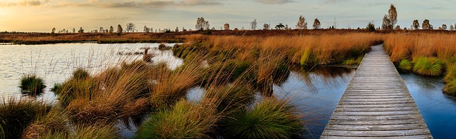
Application of wetland's trend indicators in Canada
Description
The Project objectives are:
- Collect and validate wetland's trend data sets for predefined locations in Canada using comparable high resolution data sets.
- Implement and apply the selected wetland change detection methodology using validated wetland datasets.
- Create wetland change indicators and map products on selected locations.
- Provide training and tools to enable staff to use the wetland trend model.
- Evaluate and document the validity of the methodology in a final report.
- Provide recommendations on the extension of the methodology for implementation at the national level.
Period
2019
Client name
Unité des Opérations de la gestion des données. Service canadien de la faune. Environnement et Changement climatique Canada. Gouvernement du Canada.
Funding
Gouvernement du Canada.
Wildspace Application Enhancements
Description
The project aimed to diagnose the system at the application level in order to highlight bugs and make it bilingual. The main activities were: bug fixing and System testing; creation of a new version of the System Applications Component (updates to operating systems and the programming environment); delivery of the new code to Environment Canada; creation of a new graphical interface for displaying data; creation of a new "Client / Management" version of the System; and making recommendations on developments.
Period
2013
Client name
Environnement Canada (Ministère)
Funding
Gouvernement du Canada
GKMI Graphical User Interface Development.
Description
The project aimed to design and develop a bilingual graphical interface in a Windows environment in harmony with ArcSDE for SQL Server 2008 Express. The mission allowed to diagnose the GKMI system and proposed solutions to improve it. It also allowed to detect and fix bugs, provide the code, produce and install the software with the bilingual user guide. The project ended with the formulation of recommendations for future development to Environment Canada.
Period
2012-2013
Client name
Environnement Canada (Ministère)
Funding
Gouvernement du Canada
Pilot Project on Data Interoperability
Description
The firm analyzed the structure of the Wildspace System database and the Geospatial Science and Technology Canada Portal for data compatibility. It determined the data transfer and management modules, developed and tested a pilot project on data accessibility, the interoperability link between the two systems. The project ended with the formulation of recommendations to Environment Canada.
Period
2012-2013
Client name
Environnement Canada (Ministère)
Funding
Gouvernement du Canada
Modelling several data sets for species at risk and migratory birds and translation of habitat conservation priorities into a spatially explicit representation using existing land cover products
Description
GEOIMAGE SOLUTIONS, based on a representation using geomatic tools of habitat priorities for bird species at risk, defined a geomatic system which can contribute to the modeling of habitat priorities for bird species in general and bird species at risk in particular (using ArcGIS). A conceptual diagram of the system has been produced.
Period
2011-2012
Client name
Environnement Canada (Ministère)
Funding
Gouvernement du Canada
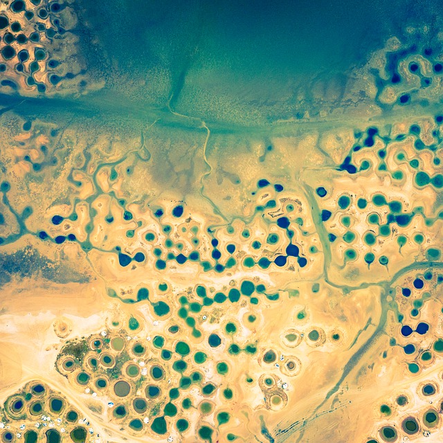
Production of a reference document on the state of the situation and trends in wetlands in Canada
Description
Based on a review of the literature on the subject, GEOIMAGE SOLUTIONS analyzed and provided a summary and recommendations on: remote sensing and GIS methods as well as the criteria used to draw up a portrait of the situation of wetlands; remote sensing and GIS methods as well as the criteria used to do diachronic or evolutionary analysis of wetlands in order to follow wetland trends in Canada; the location of strong pressures on wetlands in Canada and their analysis according to their importance; prioritization of types (anthropogenic, natural, etc.) of pressures as well as on the identification and delimitation of priority areas for sketching situational awareness and for assessing the trend of wetlands in Canada.
Period
2011
Client name
Environnement Canada (Ministère)
Funding
Gouvernement du Canada
Development of a reference document for mapping wetlands in Canada using remote sensing and the Geographic Information System
Description
GEOIMAGE SOLUTIONS has written a report on wetland mapping initiatives at Environment Canada and other government departments and agencies as well as in the provinces and territories. The project consisted of noting the main potential users, conducting a needs analysis, providing a synopsis of the expertise and capacity of the companies to map wetlands in Canada, and finally producing a report on costs, timetables and the risks (identification and management) of mapping wetlands for all of Canada.
Period
2010
Client name
Environnement Canada (Ministère)
Funding
Gouvernement du Canada

DECISION SUPPORT INFORMATION SYSTEM: JUDICIAL AREA
Development and implementation of an integrated software solution for managing national files of the Trade and Furniture Credit Register (RCCM) in the OHADA area
Description
The mission allowed to create the integrated and secure RCCM management system for monitoring procedures at the local level (Commercial Court or 1ʳᵉ instance), as well as for the transmission of data to the National File (Ministry of Justice) and the Regional File (OHADA). The main modules of the System are: the RCCM portal, real-time management and dematerialization of legal proceedings relating to the commercial register, movable credit and cooperative companies (electronic document management, electronic safe, electronic signature, Workflow, online payment, etc.). The penultimate activity of the project consisted of a major system deployment program and capacity building in OHADA countries (management and use of the System). The period 2019-2022 is devoted to the completion of installations in the countries as well as to system maintenance and technical support for users.
Period
2014-2019
2019-2022
Client name
Organisation pour l’Harmonisation en Afrique du Droit des Affaires (OHADA)
Funding
Banque Mondiale
Development and implementation of the Integrated Centralized Information System for the Republic of Djibouti (Phase 1)
Description
The project of the National Agency for the Promotion of Investments (ANPI) aimed to develop and implement the Centralized Information System (GUI) of companies and an informational and transactional web portal specific to GUI. The main modules of the System are: the GUI portal, real-time management and dematerialization of legal proceedings relating to the commercial register (electronic document management, Workflow, etc.). The final activity of the project consisted of a System deployment and capacity building program (management and use of the System).
Period
2016-2017
Client name
Agence Nationale pour la Promotion des Investissements (ANPI) de Djibouti
Funding
Banque Mondiale
Partenaire
DATASYS (Djibouti)
Development and implementation of the Integrated Centralized Information System for the Republic of Djibouti (Phase 2)
Description
The project aims to develop and implement the Integrated Centralized Information System (GUI) for companies and an informational and transactional web portal specific to GUI. The main modules of the System are: the GUI portal, real-time management and dematerialization of legal proceedings relating to the commercial register (electronic document management, Workflow, etc.). The last activity of the project consisted of a System deployment and capacity building program (management and use of the System)
Period
2017-2019
Client name
Agence Nationale pour la Promotion des Investissements (ANPI) de Djibouti
Funding
Banque Mondiale
DECISION SUPPORT INFORMATION SYSTEM: URBAN HYDRAULICS
Updating and georeferencing of the urban water cartography (Senegal)
Description
The Project objectives are:
- Design a database of the water distribution network managed by SONES.
- Develop the database.
- Link this database to the New SONES Information System which we designate by "NSI-SONES" and which will be dynamically interactive and interoperable with the GIS repository of the firm ESRI (ArcGIS).
- Train local employees on the use, management and administration of NSI-SONES.
Period
2018-2019
Client name
Société Nationale des Eaux du Sénégal (SONES)
Funding
Banque Africaine de Développement
Partenaire
OASIS MEDIA GROUP (OASIS)
DECISION SUPPORT INFORMATION SYSTEM: SOCIAL SECURITY
Creation of the New Information System (NSI) of the National Social Security Fund (CNPS)
Theme
Geomatics and IT applied to the social field
Description
The mission aims to create the New Information System (NSI) of the CNPS. The NSI aims to take into account all the services related to the main mission of the CNPS. This mission revolves around the following schemes to be covered within the scope of the NSI: the general basic scheme for employees (RG), the social scheme for the self-employed (RSTI), the complementary scheme for the self-employed (RCTI) , and the compulsory supplementary plan for employees (RCO). The development of the NSI will be based on the WORKS platform of the firm CACIOPEE (Morocco). The main modules of the NSI are: the NSI portal, the management and dematerialization in real time of the procedures relating to the management of the four regimes defined above. The last activity of the project consisted of an NSI deployment program and capacity reinforcement (management and use of the System).
Period
2017-2020
Client name
Caisse Nationale de Prévoyance Sociale de Côte d’Ivoire
Funding
Caisse Nationale de Prévoyance Sociale de Côte d’Ivoire.
Partenaire
CACIOPEE (Maroc) et BARNOIN INFORMATIQUE (Côte d’Ivoire)
DECISION SUPPORT INFORMATION SYSTEM: TERRITORY DEVELOPMENT
Implementation of the Geographic Information System (GIS) of the National Observatory of Decentralization and Local Development (ONDDL)
Description
The mission consists in setting up a dynamic GIS focused on local development, an integrative tool in terms of local government management and decision support for all employees. The mission made it possible to identify the needs and analyze the existing GIS in national structures and local communities in Senegal in coherence; designed and developed GIS with a multi-scale dynamic mapping module; set up the web portal; installed the tools at the customer's site; and trained administrators and users of the System.
Period
2016 – 2017
Client name
Agence de développement local (Gouvernement du Sénégal)
Funding
Gouvernement du Sénégal
Partenaire
OASIS MEDIA GROUP (Sénégal)

DECISION SUPPORT INFORMATION SYSTEM: TOURISM
Establishment of a e-tourism platform aimed at promoting and marketing the Cameroon destination
Description
The mission allowed to design and develop the e-tourism platform for the promotion and marketing of the Cameroon destination. The main modules of the System are: the e-tourism portal, real-time management and dematerialization for entering complete information on tourism marketing (electronic document management, management of online purchases and sales, monitoring and evaluation of transactions , etc.). The firm has produced a collaboration charter between the private sector, the Ministry of Tourism and Leisure and the body responsible for managing the platform, etc. The last activity of the project consisted in deploying the System to the Ministry and training many actors in the tourism sector (management and use of the platform).
Period
2014-2016
Client name
Projet de compétitivité des filières de croissance du Cameroun et Ministère du tourisme du Cameroun
Funding
Banque Mondiale
INFORMATION SYSTEMS (IS) AUDIT AND IT BLUEPRINT
Audit of the Information System of the Beninese Electric Power Company (SBEE) and update of its IT plan.
Description
As part of the audit of the existing system and the diagnosis of the Information System (IS), GEOIMAGE SOLUTIONS carried out an inventory of the existing IS in terms of business processes, applications, databases and infrastructure network. The firm noted the strengths and weaknesses of the IS, and analyzed threats to the existing IS. After assessing the security of the entire information system, the firm developed the IT blueprint for SBEE and provided the strategic and functional organizational plan for the future information system (five-year plan and budget for implementing the blueprint).
Period
2014
Client name
Société béninoise d’énergie électrique (SBEE)
Funding
Société béninoise d’énergie électrique (SBEE)
Partenaire
Ingénierie des systèmes d’information spécialisés Sarl (Bénin)

DECISION SUPPORT INFORMATION SYSTEM: FINANCES
Supply and installation of a centralized IT solution for monitoring the Decentralized Financial Systems (SFD) of the West African Monetary Union (WAMU)
Theme
Géomatique appliquée à la gestion financière
Description
The system designed and developed allows the collection of financial and non-financial information from MFIs in the form of discounts; the application of specification, consistency and plausibility checks on discounts; data processing, in particular for the calculation of financial and non-financial indicators for monitoring DFS; and consultation of financial and non-financial information relating to MFIs. The last activity of the project consisted in deploying the System at the headquarters of the Central Bank of West African States (BCEAO), and in training many actors in the microfinance sector from the eight WAMU countries (management and use of the solution).
Period
2013-2015
Client name
Banque Centrale des États d’Afrique de l’Ouest (BCEAO)
Funding
LuxDev (Luxembourg) et BCEAO
CADASTRAL GEOMATICS
Development of geomatics tools for the manipulation of cadastral data
Theme
Cadastral geomatics
Description
Development of several geomatic tools allowing the manipulation of cadastral data (cadastral renovation, graphic extensions, cadastral operations in renovated territory) using ArcGIS software. System user training.
Period
2013-2014
Client name
Cadrin Jean-Pierre & Ass. Sherbrooke, Québec, Canada.
Funding
Cadrin Jean-Pierre & Ass
Design and implementation of the computerized system and interconnection of the Directorate of Domains, Registration and Stamp (DDET) of Benin.
Description
The project made it possible to carry out several activities leading to the implementation of the System (single station and network): audit of the existing at DDET (data, databases, GIS, various software and computer hardware); development of a plan for the computerization of DDET operations; creation of the documentary database of land titles; creation of a geo-directory of cadastral and land data; design and development of the Benin Web Cadastral Management System; interconnection of cadastral management services (Porto-Novo, Parakou and Cotonou) by setting up a geosynchronization module for databases installed on remote servers; Capacity reinforcement.
Period
2011
Client name
Millennium Challenge Account du Bénin
Funding
Millennium Challenge Corporation des États-Unis
Partenaire
CubeWerx (Canada)
URBAN INFORMATION SYSTEM WITH SPATIAL REFERENCE
Management system for the commune of Tabarre (Haiti)
Description
The infrastructure monitoring system for the commune of Tabarre (Haiti) was designed and developed. It focuses on the dynamic mapping of the indicators listed with the help of municipal managers.
Period
2011
Client name
Municipalité de Tabarre et Bureau des Nations Unies pour Haïti
Funding
GEOIMAGE SOLUTIONS INC.
Partenaire
BEJV (Haïti)

Web atlas of commercial premises in the city of Drummondville
Description
Implementation of the system for monitoring the availability of commercial premises in the city of Drummondville. The online tool allows searches based on several criteria such as the type and address of a commercial premises, socio-demographic information (income, household composition, etc.). The development of the system was accompanied by training activities for users and managers of the tool.
Period
2008-2009
Client name
Commissariat au Commerce de la ville de Drummondville (Québec, Canada)
Funding
Commissariat au Commerce de la ville de Drummondville
Industry and commerce system
Description
GEOIMAGE SOLUTIONS designed and developed the online information system on the spatial organization of industries and businesses in the Center-du-Québec region (Quebec, Canada), based on PostgreSQL, PostGIS and SVG technologies. The project ended with training and installation of the system at the customer's site.
Period
2005
Client name
Agence Géomatique du Centre-du-Québec (AGCQ)
Funding
Agence Géomatique du Centre-du-Québec (AGCQ)
DIGITAL MAPPING
Radionavigation and land use mapping from the National Civil Aviation Agency (ANAC) of Benin.
Description
The mission produced a series of digital and analogical thematic maps (paper) of various types and scales: General maps of Benin at scales of 1: 500,000, 1/200,000, and 1: 100,000; 1: 50,000 maps of southern and northern Benin; Cotonou and Littoral maps at 1: 50,000; Aeronautical radionavigation, aerodrome and approach charts at the scales of 1: 500,000, 1/200,000 and 1: 100,000; “Tactical Pilotage Chart” and “Joint Operation Graphic” cards at 1/250 000.
Period
2011-2013
Client name
Agence Nationale de l’Aviation Civile (ANAC) du Bénin
Funding
Banque Mondiale
Partenaire
Palmarès Technologies R&D S.A.
Analysis of the spatial organization of employment and commuting in the Mauricie region (2001 and 2006 censuses)
Description
The system developed is centered on a database relating to the various indicators characteristic of employment. This interactive Web tool allows the consultation of maps on employment, the analysis of statistical data on employment in the region and in Quebec. The development of the electronic atlas was accompanied by training activities for users and managers of the tool.
Period
2009-2010
Client name
Ministère de l’Emploi et de la Solidarité sociale du Québec (Direction régionale de la Mauricie). Canada.
Funding
Gouvernement du Québec.
Analysis of the spatial organization of employment and commuting in the Centre-du-Québec region (2001 and 2006 censuses)
Description
The system developed is centered on a database relating to the various indicators characteristic of employment. This interactive Web tool allows the consultation of maps on employment, the analysis of statistical data on employment in the region and in Quebec. The development of the electronic atlas was accompanied by training activities for users and managers of the tool.
Period
2005-2008
Client name
Ministère de l’Emploi et de la Solidarité sociale du Québec (Direction régionale du Centre-du-Québec). Canada.
Funding
Gouvernement du Québec.
Partenaire
Université de Sherbrooke et Vexcel Canada.
DECISION SUPPORT INFORMATION SYSTEM: EDUCATION
Design and Implementation of the Burkina Faso Education Governance Support System (SAGE-FASO)
Description
The aim of this project was to improve the quality of work within the Department of Basic Education by setting up an Intranet network and databases. This mission made it possible to carry out the following activities: the design of the database on the education system; the design and development of the geographic information system coupled with the database; the design and development of the SAGE-FASO cartographic charter with a view to its dynamically interactive use; capacity reinforcement.
Period
2009-2010
Client name
Ministère de l’Enseignement de Base et de l’Alphabétisation du Burkina Faso
Funding
Banque Mondiale et partenaires financiers
DECISION SUPPORT INFORMATION SYSTEM: INTEGRATED WATER MANAGEMENT
Feasibility study and implementation of a water information system (SIE) at the General Secretariat of the Economic Community of Central African States (CEEAC)
Description
The firm carried out the following activities: audit of the existing (data, metadata, institutions, equipment and software); development of a complete regional EIS proposal (preparation of the feasibility study report, presentation and validation of the study report on the needs and methods of setting up the database and GIS, estimation of SIE development costs). The project ended with the preparation of a regional plan to strengthen the capacities of national water employees in the management of SIE.
Period
2011
Client name
Communauté Économique des États de l’Afrique Centrale (CEEAC)
Funding
Banque Africaine de Développement
Strategic assessment of environmental and socio-economic data and information management in the Niger Basin.
Description
The companies have proposed a sustainable system for processing and sharing data, specifying the responsibilities of each actor and the practical and technological methods of implementing this system, including an online geo-directory.
Period
2008
Client name
Autorité du Bassin du Niger (ABN)
Funding
Autorité du Bassin du Niger (ABN)
Partenaire
CRC SOGEMA (Canada)
Aquifer and River Basin Resource Evaluation (ARBRE) – Burkina Faso
Description
The mission developed operational methods for water management in the Sahelian environment (surface water, water use, groundwater, change detection, wetlands, water-related diseases) based on remote sensing (treatment radar and optical images) and geographic information systems (digital mapping and organization geomatization). Capacity reinforcement was the last activity of the project.
Period
2005-2008
Client name
Agence Spatiale Canadienne (Programme TIGER). Canada
Funding
Agence Spatiale Canadienne
Partenaire
Université de Sherbrooke et Vexcel Canada
DECISION SUPPORT INFORMATION SYSTEM: AGRICULTURE
Development of a geo-directory for agricultural advisers in Quebec (AgriMatic system module).
Description
An archiving module for spatial reference data has been developed. The project resulted in the posting of a geo-directory for everyone in the Quebec agricultural community (module of the AgriMatique system). The development of the geo-directory was accompanied by training activities for users and managers of the tool.
Period
2009-2010
Client name
Ministère de l’Agriculture, des Pêcheries et de l’Alimentation (Programme Initiative d’appui aux conseillers agricoles). Gouvernement du Québec. Canada
Funding
Gouvernement du Québec
Web tool for consulting Agri-food offers and services in Centre-du-Québec
Theme
Géomatique appliquée à l’agriculture
Description
GEOIMAGE SOLUTIONS has developed the Web tool for consulting agri-food offers and services in Centere-du-Québec. This tool makes it possible to search for: a certain category of business, (eg producers in Centre-du-Québec); companies that offer a certain type of product (eg meats, fruits and vegetables); businesses residing in a municipality.
Period
2009
Client name
Corporation de développement agroalimentaire-forêt du Centre-du-Québec
Funding
Corporation de développement agroalimentaire-forêt du Centre-du-Québec
Support system for agricultural advisers in Quebec (AgriMatique)
Description
The AgriMatique system was fundamentally created to support all of Quebec's agricultural advisers in their activities of supervision and support for agricultural production, with regard to applications at the plot, farm, and territory. The development of the system was accompanied by training activities for users and managers of the tool.
Period
2007-2008
Client name
Ministère de l’Agriculture, des Pêcheries et de l’Alimentation (Programme Initiative d’appui aux conseillers agricoles). Gouvernement du Québec. Canada
Funding
Gouvernement du Québec
Partenaire
Agence Géomatique Centre-du-Québec
GEOMATICS: TECHNOLOGICAL DEVELOPMENT
Deployment of a Geosynchronization service for databases
Description
The Canadian companies CUBEWERX and GEOIMAGE SOLUTIONS have designed, developed and installed in an operational environment a new Geosynchronization Service for databases installed on remote servers. This Service facilitates the interoperability of remote servers within an organization with regard to the exchange of data with spatial reference. This product has become an OGC (OpenGis Consortium (OCG)) standard in geomatics.
Period
2008-2009
Client name
GeoConnections (Ministry of Natural Resources Canada), Ministères des Ressources Naturelles du Québec, et le Ministère des Transports du Québec. Canada
Funding
GeoConnections (Ministry of Natural Resources Canada)
Partenaire
CubeWerx (Canada)
Study for the implementation of the Geographic Information System (GIS) coupled with a monitoring and evaluation information system (SISÉ).
Description
The firm designed and developed a GIS equipped with a map generator, compatible with the SISÉ of MCA-Benin. Technological innovation consisted in using free software resources and geomatics on the Web in a participatory systemic approach to produce two products in one: a dynamic thematic mapping module for better knowledge of a phenomenon over time and in the space ; and a module of spatial analysis specific to the needs of the user to represent geographically an indicator linked to a given activity. Capacity reinforcement was the last activity of the project.
Period
2008-2009
Client name
Millennium Challenge Account (MCA) Bénin
Funding
Millennium Challenge Corporation (États-Unis)
Partenaire
CRC SOGEMA (Canada)
GEOSCIENTIFIC INFORMATION SYSTEM (MOON AND MARS PLANETS)

WEB GIS for planetary and terrestrial geoscience databases: the Moon, Mars and similar terrestrial sites.
Description
GEOIMAGE SOLUTIONS carried out a feasibility study on the establishment of an Internet mapping system for the study of terrestrial, lunar and Martian craters. This study provided an analysis of the free solutions currently available for terrestrial areas: studies of free solutions in the field of GIS on the Web; analysis of the capabilities of tools to manage non-terrestrial coordinate systems; inventories of data sources on lunar, Martian and terrestrial craters; development of prototypes for viewing crater data.
Period
2008
Client name
Agence Spatiale Canadienne. Canada
Funding
Agence Spatiale Canadienne. Canada