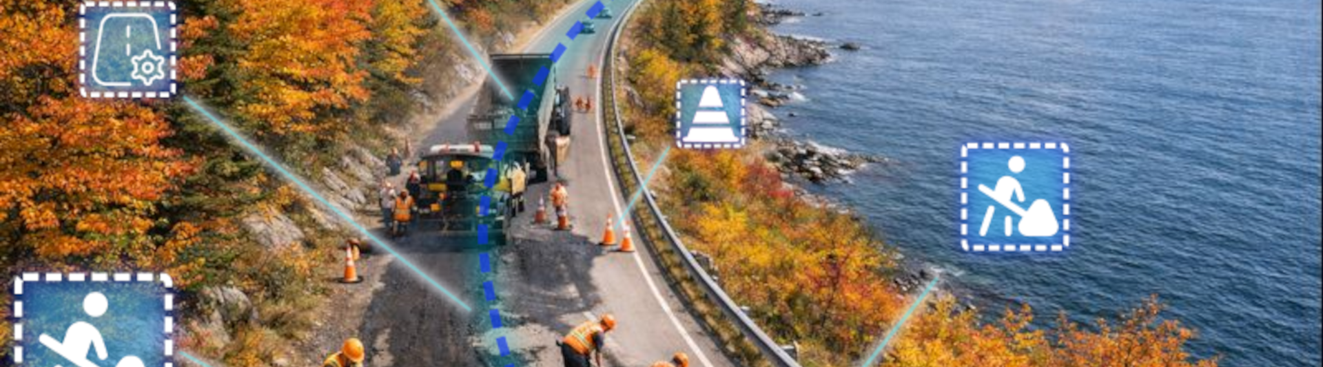
Today, road maintenance is a major challenge for municipalities and companies. Manual inspections are time-consuming, costly, and sometimes unreliable. To address this challenge, our company has developed an innovative solution that uses artificial intelligence to automatically analyze images collected by vehicles, detect cracks, and provide actionable data through an interactive dashboard.
Image Collection
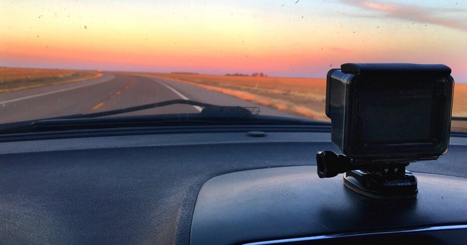
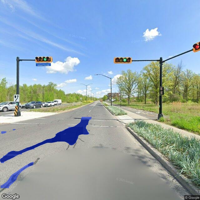
Our solution relies on vehicles equipped with cameras that travel the roads to capture high-resolution images, similar to those used by services like Google Street View. These images serve as the essential data for our analysis.
Crack Analysis with AI
Using computer vision algorithms, our system identifies cracks and other defects on the pavement. Each image is automatically analyzed to detect the presence, size, and severity of cracks, providing an accurate assessment of road conditions. offrant ainsi une évaluation de l’état des routes.
Data Management
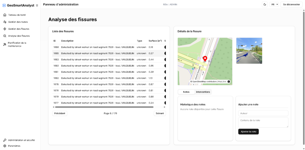
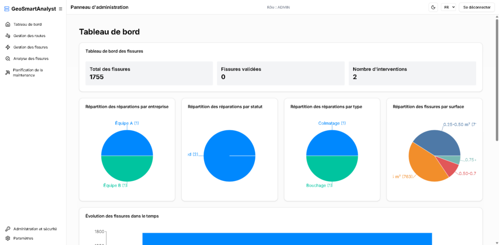
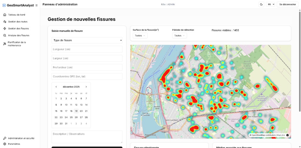
All collected information is centralized in a secure database. Each detected crack is recorded with its GPS location and characteristics, allowing for precise and historical tracking of road conditions.
Visualization via a React Dashboard
To make this data accessible and actionable, we have developed an interactive dashboard. Users can view road conditions, filter by area or severity, and generate detailed reports to plan maintenance effectively.
Integration of Spatial Information
A geospatial approach allows:
- Display of interactive maps, heatmaps, and location-based filters on the dashboard, offering an intuitive experience for road managers.
- Visualization of the most deteriorated areas to prioritize interventions.
- Cross-referencing of data with other information, such as road age, for more detailed analyses.